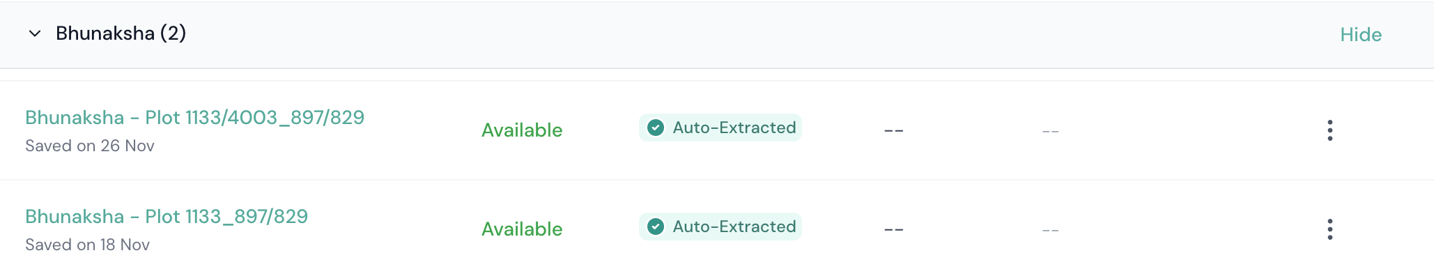
Bhunaksha Odisha
Find Your Plot Details
Get your RI Circle, plot number and land details instantly. Enter your district, tahasil, village and Khata number to get everything you need to open Bhunaksha Odisha.
What is Bhunaksha?
Bhunaksha is the cadastral map layer maintained by the Revenue department of Odisha. Every survey plot in the state has a unique number and a mapped boundary on this system.
Cadastral Map
A cadastral map shows individual land parcels with their shape, size, and relative position. It is the graphical counterpart to the textual RoR (Record of Rights).
Plot Boundary
Each plot has a defined polygon on the map. This boundary tells you where your land starts and ends, and how it sits relative to roads, water bodies, and neighbouring plots.
Official Government Data
Bhunaksha maps are sourced from the Survey and Settlement records of the Odisha Revenue department. The portal bhunakshaodisha.nic.in is the official platform to access them.
Key difference from Bhulekh: Bhulekh tells you who owns a plot (text record). Bhunaksha shows you roughly where it is, what shape it has, and who the neighbours are (visual reference). Use both together for a complete picture.
Skip the portal
TLB shows Bhunaksha alongside your RoR instantly
Instead of filling 5 dropdowns on the government portal, TLB fetches the Bhunaksha for your plot automatically. No RI Circle hunting needed.
Five things you need to find your plot on Bhunaksha
Bhunaksha is a viewer, not a search engine. You have to tell it exactly where to look. Here is what you need before you visit bhunakshaodisha.nic.in.
District
One of Odisha's 30 districts. Easy — pick from the dropdown first.
Tehsil
The sub-district administrative unit. Loads after district is selected.
RI Circle — the tricky one
A cluster of villages under one Revenue Inspector. Most people don't know theirs because Bhulekh doesn't need it and RoR doesn't always show it prominently. See the section below on how to find yours.
Village (Mouza)
Your revenue village. Use the official spelling from your RoR. Common spellings sometimes differ from the portal's list.
Plot Number
From your Bhulekh RoR. Bhunaksha only searches by plot number — unlike Bhulekh which accepts owner name or Khata too. Include the slash if it has one (e.g., 1133/4003).
Look up how to find your plot number from your RoRSheet number is optional. Some portal versions also ask for a Sheet Number. If your village spans multiple sheets, try sheet 01, 02, 03 in order until your plot appears. The system usually picks the right one automatically after you enter the plot number.
What is RI Circle and why is it hard to find?
What is an RI Circle?
RI stands for Revenue Inspector. An RI Circle is a cluster of villages administered by one Revenue Inspector. Bhunaksha organises its maps by survey sheet, which is filed under RI Circle. Bhulekh is indexed by Khatiyan account number and doesn't need it — which is why most people have never had to know their RI Circle.
Why it causes problems
If you select the wrong RI Circle, the Village dropdown that loads next will not contain your village at all. People then assume it's a portal error and give up. The RI Circle is simply not shown on most documents people routinely have — so most users have to look it up before they can use Bhunaksha.
How to find your RI Circle
- Check the header of your Bhulekh RoR — the RI Circle is sometimes listed in the location details at the top.
- Ask a neighbour with land in the same village — they will know the RI Circle name.
- Visit the Tahasildar's office — they have the village-to-RI mapping on record.
- Use the free TLB Find RI Circle tool — select your district, tahasil, and village to get the answer instantly.
What you will see on the Bhunaksha portal
Once you enter all five location fields and your plot number, this is what the portal shows you.
Your plot (dark navy polygon)
The dark-coloured polygon is the plot you searched for. Its plot number, owner name, and area appear in the Plot Info panel on the left.
Same-Khata plots (sky blue)
A lighter sky-blue polygon marks another plot under the same Khata — the same owner family. Useful for seeing your family's full land holdings in the village.
Plot Info panel
Shows the owner's name, father's name, and area in acres and hectares. Same data as your Bhulekh RoR. Click any neighbouring polygon to see its owner too.
RoR cross-links
Three links on the panel: ROR Front Page, ROR Back Page, and ROR Home Page. Clicking any opens the linked Bhulekh RoR for that plot. Always cross-verify — if they disagree, the RoR is the legal record.
Map Report (PDF download)
Click Map Report to generate a downloadable PDF showing your plot, its neighbours, basic measurements, and the village header. Useful for sharing with buyers or family.
North arrow on the Map Report
Indicates which direction is north on the sketch. The map may not be drawn with north at the top. Always check the north arrow before assuming orientation.
Neighbouring plot numbers
Numbers labelled in surrounding polygons. Click any to see that plot's owner and area. These should match the Chouhadi (four-direction boundary description) in your RoR.
Map Report is not to scale
The bounded sketch in the Map Report PDF is indicative only. Proportions and angles are approximate. Do not measure distances from it. For accurate boundaries, apply for a physical demarcation at the tahasil.
Important to understand
The map is a reference, not the legal authority
Unlike your Sale Deed, Encumbrance Certificate, or RoR — which are primary legal documents — Bhunaksha is a visual reference.
1. If your plot doesn't appear on Bhunaksha, it does not mean the land doesn't exist. It usually means the digital map for that area hasn't been updated yet. Your paper records, your Bhulekh RoR, and your Sale Deed remain fully valid.
2. If the plot shape looks wrong, the map may be wrong, not your land. Old chain-and-rope surveys (mostly from the 1960s) drift 5 to 15 percent from current GPS reality. Digitisation errors happen too. For legally accurate boundaries, apply for a physical demarcation by a licensed surveyor at the tahasil.
The map is still useful for orientation, identifying neighbours, and cross-referencing with your RoR. Just don't treat it as the final word on your boundary.
When things don't work as expected
Plot not found or plot doesn't appear
- Wrong sheet number. A village can have 10 or more sheets — try adjacent numbers (01, 02, 03) until your plot appears.
- Your records may have a Sabik (old) plot number but the portal uses Hal (current) numbers. Get the Hal number from the RI office.
- Wrong RI Circle. If you guessed it, verify via the TLB dashboard or at the tahasil.
- Mapping incomplete. Some villages still have un-digitised areas. Your Bhulekh RoR remains legally valid regardless.
Plot shape on the map doesn't match the ground
- If you just need the map fixed: file a map correction application at the tahasil with your RoR and supporting documents.
- If you need legally accurate boundaries for a transaction or dispute: apply for a physical demarcation by a licensed surveyor at the tahasil.
Old chain-and-rope era surveys drift 5 to 15 percent from current GPS reality. This is normal across Odisha.
Plot area on the map differs from the RoR
- The RoR is the legal record. If the map and RoR disagree, trust the RoR.
- If the discrepancy is under 2 percent, treat the RoR as authoritative.
- If the discrepancy is significant, file a reconciliation application at the tahasil.
The map's polygon area is computed from the digital drawing. If the drawing was slightly off, the computed area will be slightly off too.
Portal doesn't load or loads very slowly
- Use Chrome or Edge. They handle Bhunaksha's map rendering most reliably.
- Disable ad-blockers for bhunakshaodisha.nic.in.
- Allow cookies and JavaScript.
- Try late evenings (8 to 11 PM IST). Heavy traffic during the day slows the portal.
Why the map matters before any transaction
Most land disputes in Odisha involve boundary disagreements or encroachment. Always check the Bhunaksha before buying, selling, or mortgaging land.
See the exact plot boundary
The cadastral map shows the precise shape and boundary of a plot on the ground. Useful for verifying that what is on paper matches what is on the ground.
Check neighboring plots
Bhunaksha shows surrounding plots and their numbers. You can verify that your plot is not encroached upon or incorrectly merged with adjacent land.
Spot irregular shapes and road access
Some plots have narrow frontage, irregular shapes, or no road access. The map makes this visible before you commit to any transaction.
Verify area against RoR
Cross-check the area shown in the map against the area in the RoR (Bhulekh record). Any mismatch is a red flag that needs investigation.
Bhunaksha and Bhulekh: what each one tells you
Both are official government records. Together they give you a complete picture of any land parcel in Odisha.
| Feature | Bhunaksha | Bhulekh (RoR) |
|---|---|---|
| What it shows | Map: plot boundary and shape | Text: owner, kisam, area, dues |
| Portal | bhunakshaodisha.nic.in | bhulekh.ori.nic.in |
| Format | Graphical / visual | Text document (RoR) |
| Needs RI Circle? | Yes | No |
| Searchable by owner name? | No — plot number only | Yes |
| Best used for | Verifying boundary and shape | Verifying ownership and rights |
| Together they tell you | Where the land is and what it looks like | Who owns it and on what terms |
See your Bhunaksha alongside your RoR in one place
TLB shows the Bhunaksha map for your plot directly inside the dashboard alongside your RoR, benchmark valuation, and other records. No switching between multiple government portals.
Key links for Odisha land records
Frequently asked questions
Common questions about Bhunaksha in Odisha.
What is Bhunaksha Odisha?
Bhunaksha Odisha is the official cadastral map system at bhunakshaodisha.nic.in, maintained by the Revenue and Disaster Management Department, Government of Odisha. It shows every recorded plot as a polygon on a digital map, linked to the corresponding Bhulekh RoR. It is a visual reference, not a primary legal document.
View your plot map on TLBWhat is the difference between Bhunaksha and Bhulekh in Odisha?
Bhulekh shows the RoR (Record of Rights): textual land records like owner name, khata, kisam, and area. Bhunaksha shows the cadastral map, the physical boundary and shape of the plot on the ground. Both together give a complete picture of any land parcel.
See both RoR and Bhunaksha on TLBWhy does Bhunaksha need RI Circle when Bhulekh doesn't?
Bhunaksha is organised by survey sheet, which is filed under RI Circle. Bhulekh is indexed by Khatiyan account number. Same underlying data, different indexes — which is why one needs RI Circle and the other doesn't.
Find your RI Circle on TLBIs Bhunaksha Odisha legally valid?
Bhunaksha is a visual reference layer, not a primary legal document. Sale Deed, Encumbrance Certificate, and RoR are the primary legal documents. For legal disputes or mutations, you need certified copies from the Tahasildar. A wrong map does not affect your ownership rights, but a wrong RoR or Sale Deed does.
Talk to a TLB land expertWhy does my plot not show on Bhunaksha?
It does not mean the land doesn't exist. Common reasons: wrong RI Circle, wrong sheet number (try 01, 02, 03), the plot is a part-plot with a slash number (include the slash when searching), or the village maps have not been fully digitised yet. Your paper RoR and Bhulekh record remain legally valid regardless.
Get help from a TLB expertWhat if the plot shape on Bhunaksha looks wrong?
The map may be wrong, not your land. Old chain-and-rope surveys drift from GPS reality, and digitisation errors happen. For an accurate boundary, apply for a physical demarcation by a licensed surveyor at the tahasil. To fix the map itself, file a map correction application at the tahasil.
Talk to a TLB land expertCan I download the Bhunaksha for my land in Odisha?
Yes. After selecting all five location fields and entering your plot number, click Map Report to generate a downloadable PDF showing your plot, its neighbours, and basic measurements. The sketch is indicative only and not to scale. TLB also shows the Bhunaksha map inside the dashboard alongside your RoR.
Open TLB to view your mapCan I use a Bhunaksha screenshot for a legal proceeding?
Generally no. Courts and Sub-Registrars require certified copies of underlying documents such as RoR, FMB sketch, and sale deed. The Bhunaksha view is an indicative reference. For legal purposes, get certified extracts from the tahasil.
Talk to a TLB land expertDoes TLB show Bhunaksha for my land?
Yes. The TLB dashboard shows the Bhunaksha map directly alongside the RoR and other land data for your plot. You can view the boundary and area details without navigating between government portals.
Check your land on TLBNeed help reading your Bhunaksha?
Our experts can explain what the map shows, identify boundary issues, and tell you what to do next.
Also useful